Other teams of various sizes did the rest.
Walk 1 - Graviers - Mourouk 1 August 2015
Our first foray was the easy route from Graviers to Mourouck.- mostly along the beach or the coastal woodland.
 |
| Start of the walk - Graviers |
This is an easy walk - mostly along the beach or the coastal pine forest.
 |
| Crowded beach |
 |
| Approaching Mourouk |
Walk 2 - Graviers - St Francois 2 August
The next day - Sunday - the bus timetable shows lots of buses going to and from Graviers. We proposed to walk from Graviers to St Francois. Possibly the fact that there is rumoured to be a restaurant/cafe at St Francois where the speciality is barbecued crayfish, and that we should be there by lunchtime had something to do with this intent.
The next day - Sunday - the bus timetable shows lots of buses going to and from Graviers. We proposed to walk from Graviers to St Francois. Possibly the fact that there is rumoured to be a restaurant/cafe at St Francois where the speciality is barbecued crayfish, and that we should be there by lunchtime had something to do with this intent.
Unfortunately, when we arrived at the bus terminus for the 0900 bus the stand was empty. We were told there "might" be one at 1200. This should have rung alarm bells, but didn't.
 |
| St Francois Bay |
We decided to reverse the walk and took the bus to St Francois, accepting that the crayfish would survive for another day.

This proved to be a more challenging walk. It takes you past three of the most scenic bays/coves on the east coast.


The path between them involves crossing the intervening headlands, in some cases the path requires scrambles up cliffs - not vertical ones.
 It also started to rain, which made the paths slippery.


All was achieved safely though and, at the end we found a small restaurant with food and beer!
 |
| Bus stop art |
After lunch we sought the bus stop for the scheduled 1430 bus back to Port Mathurin. We sat there; 1430 came and went. Locals were looking at us strangely - what are these foreigners doing? This is where we thought back - if the 0900 bus didn't run - the 1200 bus "might" run - perhaps no buses to Graviers were running.
Two cars - a saloon and a pick-up stopped and the drivers were looking at us. A deal was concluded and we got driven back to Port Mathurin for MUR 100 (GBP 1.80) each.
Walk 3 - Riviere Banane - Baladirou 5 August
The bus to the start point of this walk goes through the village of Riviere Banane, past the school and down an increasingly rough road. The conductor tells us to stay on at each stop until we reach a turning point where the road turns into a track. From there we walk through well cultivated market gardens to the start of the walk at the mouth of the River - or rather where the nearly dry river bed disappears under the sand of the beach.
The walk varies between easy track through the coastal trees to a scramble over rocks around the headlands.
Off some of the headlands there were fishermen and women - as well as sensible creatures waiting for someone else to do the work
In some cases the track markers point over the rocks despite there being a perfectly good path avoiding them. At other points, particularly towards the end the rock scramble is unavoidable and, at high tide would probably be wet.
At Baladirou - which appears to be a popular bathing spot - there were at least 5 youngsters enjoying a splash. " Which way to the bus stop?" - up a flight of steps and past the shop. The road continued to Grande Baie and Anse aux Anglais to Port Mathurin. Some hardy souls had previously completed the whole route fro Mourouk to Port Mathurin in a day.
Walk 4 - Mont Limon 13 August
 A short distance from Mount Lubin is the highest point on the island, Mont Limon 398m. A flight of steps on the right hand side of the road east towards Grande Montagne and Point Coton leads to a path to the top. Here two viewpoints afford panoramic views over much of the island. The walk up and down, including time to admire the views, maximum time- 20 minutes.

Walk 5 - Above Port Mathurin 18 August
This walk was inland from friends Tim and Liz's house on the hillside behind Port Mathurin. A group of about 15 took part.
Tim pointed out an endangered Rodrigues fody which had yet to gain its yellow chest plumage.
The walk goes uphill before crossing a river bed - nearly dry at present but could be a raging torrent in heavy rain - and along the far side of the valley to a viewpoint giving superb views over Port Mathurin and Mathurin Bay.
The bus to the start point of this walk goes through the village of Riviere Banane, past the school and down an increasingly rough road. The conductor tells us to stay on at each stop until we reach a turning point where the road turns into a track. From there we walk through well cultivated market gardens to the start of the walk at the mouth of the River - or rather where the nearly dry river bed disappears under the sand of the beach.
The walk varies between easy track through the coastal trees to a scramble over rocks around the headlands.
 |
| "Fish for lunch please" |
Off some of the headlands there were fishermen and women - as well as sensible creatures waiting for someone else to do the work
 |
| A bit of a scramble |
 |
| Baladirou - end of the walk |
Walk 4 - Mont Limon 13 August
 A short distance from Mount Lubin is the highest point on the island, Mont Limon 398m. A flight of steps on the right hand side of the road east towards Grande Montagne and Point Coton leads to a path to the top. Here two viewpoints afford panoramic views over much of the island. The walk up and down, including time to admire the views, maximum time- 20 minutes.
 |
| View to Port Mathurin |
This walk was inland from friends Tim and Liz's house on the hillside behind Port Mathurin. A group of about 15 took part.
Tim pointed out an endangered Rodrigues fody which had yet to gain its yellow chest plumage.
 |
| The river |
 |
| Mathurin Bay |
Walk 6 - Riviere Banane to Point Coton - 19 August
The 1100 bus takes a group of 5 to Riviere Banane. This time it does not take us to the end of the road and thus enables us to bypass the first headland.
 |
| First beach and headland |
We had intended to continue on to St Francois but after a good lunch in the Point Coton hotel we just went home by bus!
 |
| Shortcut - avoiding going round the end |
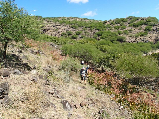 |
| On the way up to the clifftops |
 |
| Lunch and beer in sight |
 |
| Point Coton beach |


